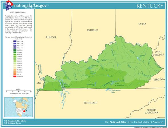
 Kentucky Annual
Rainfall and Climate Data, see below for individual
cities
Kentucky Annual
Rainfall and Climate Data, see below for individual
cities
Kentucky Annual
Rainfall and Climate Data, see below for individual
cities
Kentucky city precipitation totals
| City |
Avg Annual Precip |
Avg Annual Snow |
Avg # days of Precip |
Avg # Thunderstorm days |
Avg # Hail days |
Avg # severe thunderstorm watches per year | Avg # tornado watches per year | # of tornadoes reported in county, 1960-2010 |
| Jackson | 49.38 | 22.9 | 142 | 53 | 1 | 3 | 9 | 4 |
| Lexington | 45.91 | 15.9 | 130 | 44 | 1 | 5 | 9 | 7 |
| Louisville | 44.54 | 16.2 | 125 | 45 | 1 | 6 | 10 | 14 |
| Paducah | 49.24 | 11.1 | 111 | 51 | 1 | 9 | 9 | 11 |
|
||||||||
Kentucky Precipitation Records
- Driest location ranked by lowest annual average precipitation: Wheelersburg, eastern Kentucky, 38.38"
- Wettest location ranked by highest annual average precipitation: Closplint, southeastern Kentucky, 58.92"
- Snowiest location ranked by highest annual average snowfall: Covington, northern Kentucky, 23.6"
- State precipitation maximum for 24 hours - Louisville, northern Kentucky, 3/1/1997, 10.48"
- State precipitation maximum for 1 year - Russellville, southern Kentucky, 1950, 79.68"
- State snow maximum for 24 hours - Hazard, southeastern Kentucky, 3/14/1993, 25.0"
- State snow maximum for 1 season - Benham, southeastern Kentucky, 1959, 108.2"
- During the year 2011, Kentucky experienced an all-time record 52 tornado reports, breaking the previous record during 1997 when only 39 were reported.
- On February 13, 1989, thunderstorms produced heavy rain and flash flooding in Kentucky. Up to ten inches of rain flooded western Kentucky in two days, with five day totals ranging up to 13.16 inches at Gilbertsville Dam, Ky. Flooding caused tens of millions of dollars damage, including 18 million dollars of damage at Frankfort, Kentucky
- On January 20, 1978, La Grange in Oldham County measured snow depth of 31 inches, the highest ever recorded in Kentucky
- Kentucky temperature averages and extremes, precipitation and temperature data for all U.S. states and interesting Top 10 U.S. climate extremes
Data sources: National Climatic Data Center, severe thunderstorm / tornado watch data period is 1999 - 2008, NOAA Storm Prediction Center, Tornado climate data - NOAA Storm Prediction Center
State lightning flash density average - 1997-2011, Vaisala