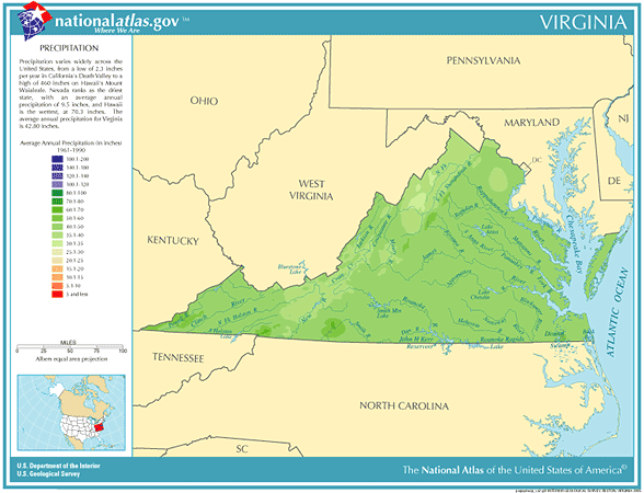
 Virginia
Annual
Rainfall and Climate Data, see below for
individual
cities
Virginia
Annual
Rainfall and Climate Data, see below for
individual
cities
Virginia
Annual
Rainfall and Climate Data, see below for
individual
cities
Virginia city precipitation totals
| City |
Avg Annual Precip |
Avg Snow Annual |
Avg. days of Precip |
Avg # thunderstorm days |
Avg # hail days | Avg # severe thunderstorm watches per year | Avg # tornado watches per year | # of tornadoes reported in county, 1960-2010 |
| Lynchburg | 43.31 | 18.1 | 119 | 42 | 1 | 1 | 7 | 0 |
| Norfolk | 45.74 | 7.9 | 115 | 37 | 1 | 5 | 7 | 10 |
| Richmond | 43.91 | 13.8 | 113 | 43 | 1 | 4 | 9 | 6 |
| Roanoke | 40.6 | 23.2 | 101 | 35 | 1 | 1 | 7 | 1 |
|
||||||||
Virginia Precipitation Records
in early August and September and rarely appear before June or after November. During the month of
September, 10 to 40 percent of Virginia’s rainfall comes from tropical systems or their remnants
thunderstorm every ten years during January compared with nine thunderstorms each July
interesting Top 10 U.S. climate extremesData sources: National Climatic Data Center, Severe thunderstorm / tornado watch data period is 1999 - 2008, NOAA Storm Prediction Center, Tornado climate data - NOAA Storm Prediction Center, State lightning flash density average - 1997-2011, Vaisala